TTC GPS Validation
I recorded my iPhone's GPS position over time while taking the streetcar across Toronto so that I could compare it with the official GPS position reported by the TTC, the results are both great and meh at the same time.
As a summary, I went from Long Branch (the west end) eastward to Spadina. Half way through (at Humber Loop) all the streetcars were turning around in both directions so I had to transfer to a different streetcar, which continued my trip to Spadina. I took the GPS positions and converted them to UTM and then converted to a "distance along shape" in meters with the street car stops labelled as shown in the following plot. It's all a bit hand wavy but I guess you just have to trust me.
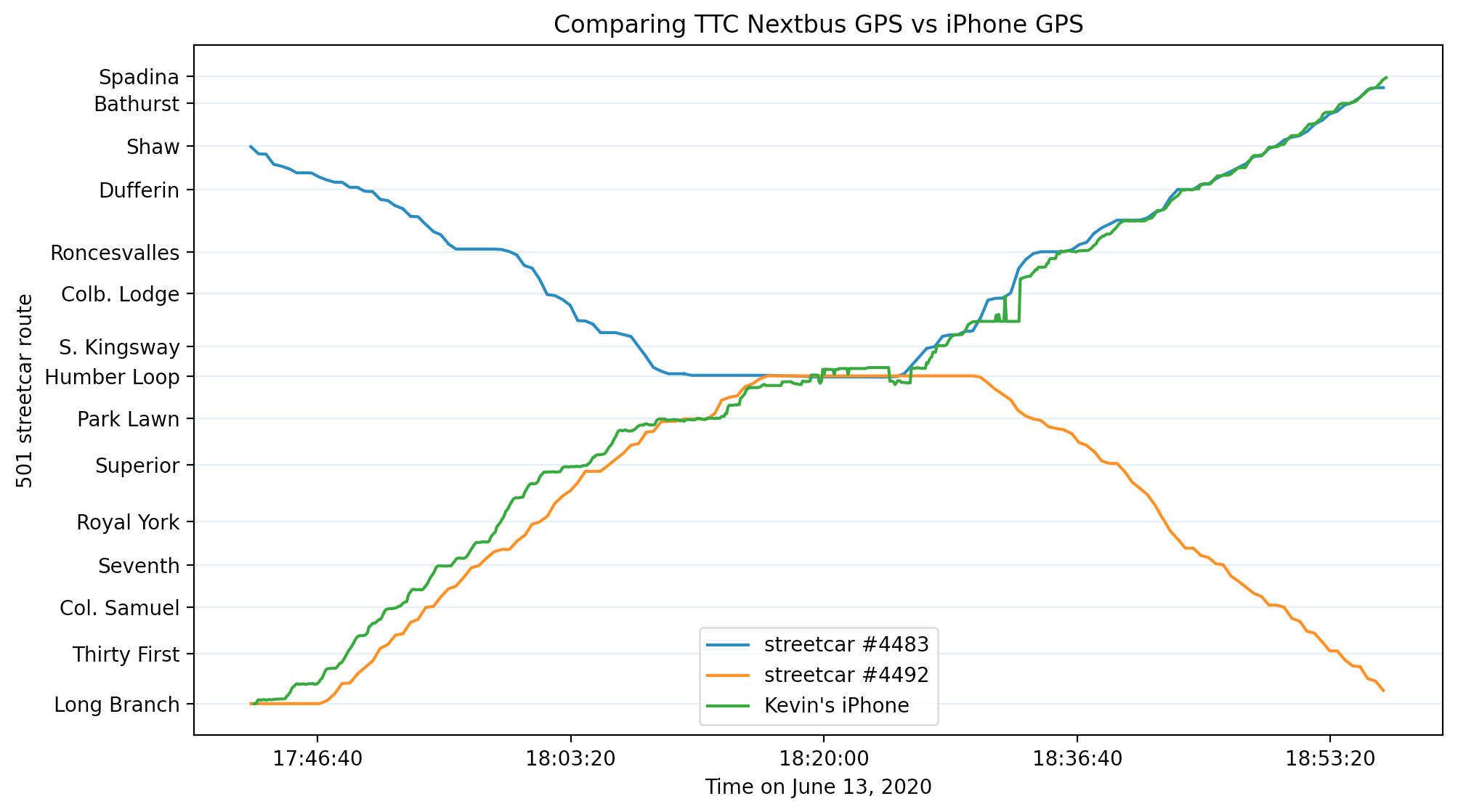
As you can see, it becomes pretty accurate east of Dufferin but the previous vehicle near Royal York is actually pretty terrible, sometimes as bad as 2 minutes incorrect. That doesn't sound like a big deal, but that could end up being a totally different vehicle. I'm not sure if it's my error or the TTCs and I'm not going to form an opinion until I have more data - a single ride is definitely not enough that's for sure. Still interesting enough to share.